Published on Tuesday, 16 July 2024 at 3:49:48 PM
Welcome to #TimeWarpTuesday and the reminder, that there used to be two churches on Camberwell Street. Did you know?
Along with Our Lady Help of Christians Catholic Church which still stands strong, there also used to be -
ST AIDAN’S ANGLICAN CHURCH, EAST VICTORIA PARK.
Around 1937 a church building, constructed in Beechboro, was moved to East Victoria Park and was consecrated as St Aidan’s Anglican Church, East Victoria Park.
It was not the most ostentatious of ecclesiastical buildings, but it seems it was a well beloved church from the mid-1930’s to sometime in the 1980s-1990s. An asbestos building, it was located at 22-24 Camberwell Street, East Victoria Park. Newspapers report in 1951 that the church was enlarged and repainted (The West Australian, 22 December 1951, p. 13).
Do you have information, photographs, ephemera etc about St Aidan’s that you can share with us? Please be in touch, e: vicparklibrary@vicpark.wa.gov.au, t. 08 9373 5500.
#LoveVicPark
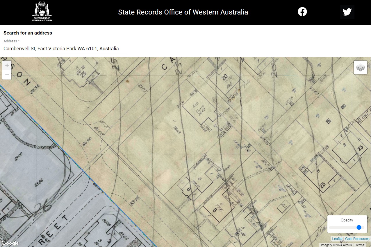
Screen shot of the section of Perth Sewerage Plans showing the intersection of Camberwell and Carson Streets, East Victoria Park. The big open block at 22-24 Camberwell Street, is the location of the “Asb Church”. The “Asb” standing for ‘Asbestos’.
RetroMaps
ABOUT THE PLANS
The historical plans available on the RetroMaps website were prepared from original surveys of the Perth area carried out by the Metropolitan Water Works Board (and subsequent departments), commencing in the early 1900s. The plans were used as part of the installation of a sewerage scheme throughout the metropolitan area during the 20th Century and, as such, are commonly known as "Sewerage Plans".
The plans were transferred from the Water Authority of WA to the State Archives Collection in the 1980s and have been in regular use since then, typically by heritage researchers or members of the public interested in the history of their own property. The plans are listed in the State Records Office's catalogue at Series 634. The hardcopy plans were digitised in 2016 and then geo-referenced to make them available through this mapping interface. https://mapping.sro.wa.gov.au/#/
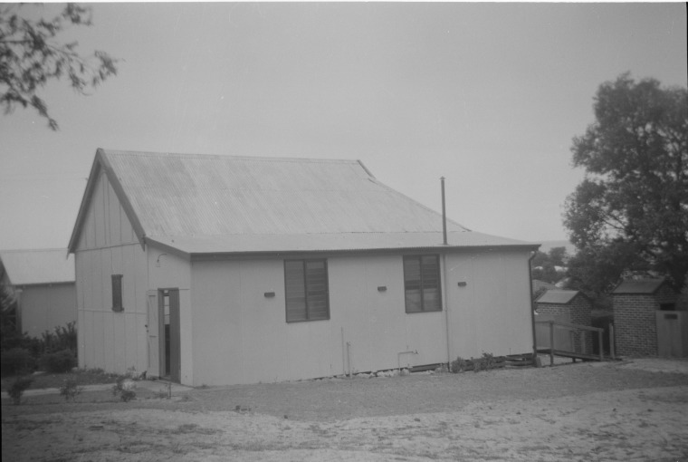
St Aidan’s Anglican Church, East Victoria Park, circa 1958
Courtesy of the State Library of Western Australia (b4487808_7)

St Aidan’s Anglican Church, East Victoria Park, circa 1958.
Courtesy of the State Library of Western Australia (b4487808_9)

St Aidan’s Anglican Church, East Victoria Park, circa 1958.
Courtesy of the State Library of Western Australia (b4487808_9)
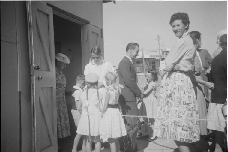
The congregation mingling and chatting following a service at St Aidan's Anglican Church, East Victoria Park
Courtesy of the State Library of Western Australia (b4487808_22).
Back to All News